Canvas GIS Advanced 9.0.4
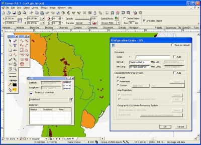
 The CANVAS 9 Advanced GIS Mapping Edition adds native support for Geographic Information System (GIS) data to Canvas.
|
The CANVAS 9 Advanced GIS Mapping Edition adds native support for Geographic Information System (GIS) data to Canvas. You can take measurements in geographic coordinates, import industry standard SHAPE and GeoTIFF files into unlimited numbers of automatically aligned overlapping layers and choose among the following options:
2,104 Coordinate Reference Systems
67 Operation Methods (like Mercator, Albers Conic Equal Area…)
1,052 Map Projections
302 Geodetic Datums
21 Angular units
45 Length units
The CANVAS 9 Advanced GIS Mapping Edition bridges the gap between dedicated GIS analysis software and generic "DTP" software. For many applications CANVAS 9 GIS Mapping Edition can now replace programs costing thousands. For the rest, CANVAS 9 GIS Mapping Edition is now the preferred "last mile" publishing companion to dedicated GIS analysis software.Files Supported include:
oMapInfo, oARC/INFO, oUSGS, Digital Line Graphs, oTIGER(Census), oMrSID (Win. only), oGML (Geography Markup Language), oSDTS (USGS Spatial Data Transfer Standard), oGIS Text oGarmin (GPS), oECW (Enhanced Compressed Wavelet Images, oS57 (IHO International Hydrographic Organization)
tags![]() gis mapping mapping edition analysis software gis analysis dedicated gis the canvas advanced gis
gis mapping mapping edition analysis software gis analysis dedicated gis the canvas advanced gis

Download Canvas GIS Advanced 9.0.4
![]() Download Canvas GIS Advanced 9.0.4
Download Canvas GIS Advanced 9.0.4
Purchase: ![]() Buy Canvas GIS Advanced 9.0.4
Buy Canvas GIS Advanced 9.0.4
Authors software
 ACD FotoSlate 4.0 build 21
ACD Systems
ACD FotoSlate: the easy-to-use photo printing software for home users and professionals.
 ACDSee PowerPack 7
ACD Systems
ACDSee is an award-winning picture viewer, graphic converter and digital image management tool.

![]() ACDSee 9 Photo Manager 9.0 build 108
ACDSee 9 Photo Manager 9.0 build 108
ACD Systems
ACDSee is an award-winning picture viewer, graphic converter and digital image management tool.
 Stitcher EZ 1.0
ACD Systems
Stitcher EZ, a plug-in to ACDSee, automatically creates panoramas, posters and virtual tours of your photos - in just two steps.
 Morpheus Photo Animator 1.85
ACD Systems
Morpheus Photo Animator is a popular graphics software program for transforming photos with special morphing and warping effects.
Similar software
 Canvas GIS Advanced 9.0.4
ACD Systems
The CANVAS 9 Advanced GIS Mapping Edition adds native support for Geographic Information System (GIS) data to Canvas.
 Canvas GIS Mapping Edition 9.0.4
ACD Systems
The CANVAS 9 GIS Mapping Edition adds native support for Geographic Information System (GIS) data to Canvas.
 Canvas Scientific Imaging Edition 9.0.4
ACD Systems
CANVAS 9 Scientific Imaging Edition offers all the features of the Professional Edition plus advanced image processing tools and direct import of DICOM format files.
 Canvas Professional Edition 9.0.4
ACD Systems
CANVAS 9 Professional Edition is the high-performance drawing environment for professionals in business, science, and engineering.
 Map Suite Desktop 2.55.0
ThinkGeo LLC
Map Suite Desktop Edition is a powerful and feature-rich .
 Map Suite Engine 2.55.0
ThinkGeo LLC
Map Suite Engine is a powerful low level component that will provide full control over your mapping presentation.
 Map Suite - Winforms Lite Edition 0.95
Spatially Aware
Map Suite Winforms Lite Edition is a powerful set of user controls enabling you to build compelling mapping applications.
 Map Suite - Winforms Edition 0.95
Spatially Aware
Map Suite Winforms Edition is a powerful set of user controls enabling you to build compelling mapping applications.
 Tralaine 5.18
RockWare USA
Tralaine was designed to help with the conversion of geographic coordinates in data files from one geographic coordinate system to another; latitudes and longitudes to State Planes or State Planes to UTM's for example.
 Process Developer Enterprise Edition 2.1
Process-Worx Ltd
A Business Process Mapping Software Product for the mapping of processes and information flows.
Other software in this category
 PhotoPrint 3.4
fCoder Group International
PhotoPrint is a professional program that you can use for pre-print processing of large image collections.
 CoffeeCup GIF Animator 7.6
CoffeeCup Software
Easy-to-use tool for creating Web animations.
 Professor Franklins Instant Photo Effects 2.0
Streetwise Software
Simply select a category and browse previews of your photo with thousands of professional photo effects.
 CreaToon 3.0
ANDROME N.V.
Its main advantages are the ease of use and the real-time feedback.
 Ameri-Imager 2.0
ThinkTank Software
Ameri-Imager is a strong all-in-one software you can use for image conversion, editing, viewing and much more.