Tiles2kml 2.31
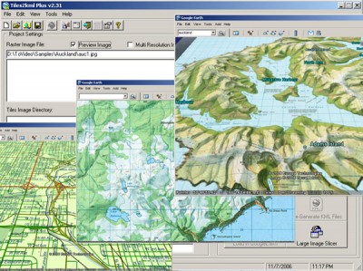
 T2K or tiles2kml will enable you to efficiently load large set of imagery or raster maps very quickly into google earth using Region-Based Network Links.
|
T2K or tiles2kml will enable you to efficiently load large set of imagery or raster maps very quickly into google earth using Region-Based Network Links. This method has an onRegion option, which specifies to load the Region data only when the Region is active.
So only the needed set of data is loaded with multiple levels of detail, larger amounts of data are loaded only when the user's viewpoint triggers the next load. Tiles2kml converts your imagery into very small tiles with different level of details allowing very quick view for very large datasets without loosing the image quality.
Tiles2kml generate very small image tiles that can be servered locally or your PC or your intranet. You can even share your imagery through the internet using the custimized kml files that links google earth client to the small tiles on your webserver. So sharing your large imagery over the internet became a very quick and easy process.
Limitations
tags![]() small tiles very quick the internet very small your imagery the region only when when the google earth
small tiles very quick the internet very small your imagery the region only when when the google earth

Download Tiles2kml 2.31
Purchase: ![]() Buy Tiles2kml 2.31
Buy Tiles2kml 2.31
Authors software
 Tiles2kml 2.31
Tiles2kml
T2K or tiles2kml will enable you to efficiently load large set of imagery or raster maps very quickly into google earth using Region-Based Network Links.
Similar software
 Tiles2kml 2.31
Tiles2kml
T2K or tiles2kml will enable you to efficiently load large set of imagery or raster maps very quickly into google earth using Region-Based Network Links.
 Tiles2kml Pro 2.31
Tiles2kml Pro
T2K Pro integrates the rich world of GIS datasets and transfers your Geographic information data into Google earth.
 Keyhole LT 2.2.990
Keyhole Inc.
Keyhole 2 LT is a software application that you download and install.
 MapContacts for Google Earth 2.0
Windswept software
MapContacts is an powerful add-in for Outlook, ACT! and Goldmine that allows you to quickly map and view a satellite image of your contact's location.
 Catfood Desktate 2.22.0003
Catfood Software
Catfood Desktate is a useful and reliable eye catching earth simulator that combines satellite imagery, near real time cloud data and optional layers including political borders, time zones and place names.
 Liquib 2.5
Jeff L. Holcomb
Liquib is a graphics tool (or toy) that attempts to translate mathematics into visual imagery.
 Google Maps Images Downloader 3.24
aaaasoft
Google Maps Images Downloader is a cute utility which can automatically download Google Maps' small tile images and then combine them into one big map image.
 40tude Time 1.0
Marcus Mönnig
40tude Time is an application that contains 5 programs: Clock, Synchronizer, Wallpaper, Calendar and Screensaver.
 KML to GPX 1.0
David Aguirre Grazio
KML to GPX converts Waypoints, Routes and Tracks from Google Earth to GPS.
 GPX to KML convertor 1.0
David Aguirre Grazio
GPS to Google Earth KML converter will convert Waypoints, Routes and Tracks from GPS to Google Earth.
Other software in this category
 AnyToJpeg 3.0
PhotoActions
There are a lot of graphic editors.
 AnyToGif 2.0
PhotoActions
There are a lot of graphic editors.
 Aeon Batch Image Editor 1.0
iRedSoft Technology Inc
Aeon Batch Image Editor is a Batch Image Processor for Webmasters and Digital Photographer.
 Image Thumbnailer and Converter 2.36f
SoftDD
Image Thumbnailer and Converter allows you to create thumbnails, convert images, and view your photos an entire folder at a time.
 WaveL CompressIt 1.5
WaveL Software
WaveL CompressIt is an utility that allows you to select the most effective compression format for storing your image files.