MagicMap 2.00
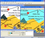
 MagicMap is a software for extracting color layers from scanned images - topo maps and logos.
|
MagicMap is a software for extracting color layers from scanned images - topo maps and logos.
tags![]()

Download MagicMap 2.00
Purchase: ![]() Buy MagicMap 2.00
Buy MagicMap 2.00
Authors software
 Silver Pilot 1.12
Two Pilots
Silver Pilot is made for conversion negatives into positives within two easy steps: you just select a clear area in the margin of the film or clear film base and press the Start button.
 PDF Creator Pilot 5.0.425
Two Pilots
PDF Creator Pilot is the library that will add rich PDF creation features to your program.
 Form Pilot Office 2.47
Two Pilots
Form Pilot Office is specially designed for filling out electronic forms of any type (PDF, DOC, XLS, TXT.
 Document2PDF Pilot 2.19
Two Pilots
Document2PDF Pilot converts MS Word, Excel, HTML, RTF, txt, mcw, xlw, wri, wps, wpt, wpd into PDF files.
 CHM2PDF Pilot 2.19
Two Pilots
CHM2PDF Pilot is an application that converts chm files into PDF documents.
Similar software
 MagicMap 2.00
Two Pilots
MagicMap is a software for extracting color layers from scanned images - topo maps and logos.
 Img2CAD 7.6
Img2cad, Inc.
Img2CAD is a stand-alone program that converts scanned drawings, maps and raster images into AutoCAD formats (such as DXF, HPGL, etc) for editing in any CAD application.
 ExpertGPS 2.3.4 Beta 7
TopoGrafix
ExpertGPS is the ultimate mapping software for Garmin, Magellan, and Lowrance GPS owners.
 Raster to Vector Standard 9.6
Raster to Vector, Inc.
Raster to Vector is a stand-alone program that converts scanned drawings, maps and raster images into accurate vector files (such as DXF, HPGL, WMF, EMF, etc) for editing in any CAD application.
 Raster to Vector Normal 9.6
Raster to Vector, Inc.
Raster to Vector Normal is a stand-alone program that converts scanned drawings, maps and raster images into accurate vector files (such as DXF, HPGL, WMF, EMF, etc) for editing in any CAD application.
 Raster to Vector Gold 9.6
Raster to Vector, Inc.
Raster to Vector Gold is a stand-alone program that converts scanned drawings, maps and raster images into accurate vector files (such as DXF, HPGL, WMF, EMF, etc) for editing in any CAD application.
 Stitch Maps 2.40
Petr Bezdecka
The maps used as basis for the assembly were either created by scanning templates, or by exports from digitalized maps.
 WEB MAPS 1.0
SharewareLab
WEB MAPS allows you to search maps of any country, state, city or province.
 ICE Color 1.4
ICE Graphics
ICE Color is specifically created for Image Enhancement and Color Correction of digital camera or scanned photo images.
 VIGps 1.0
Valeri Vlassov
VIGps is a program that will allow you to see route lines and maps.
Other software in this category
 WinCal 4.9.0
TechSys Consultants Pty. Ltd
As we say, it is your personal photo calendar, Certificates and advertisements design and publishing tool.
 Color Wheel Pro 2.0
QSX Software Grou
Color Wheel Pro is the only tool that allows you to see color theory in action: you can create harmonious color schemes and preview them on real-world examples.
 Silver Pilot 1.12
Two Pilots
Silver Pilot is made for conversion negatives into positives within two easy steps: you just select a clear area in the margin of the film or clear film base and press the Start button.
 ReaWatermark 2.1
ReaSoft Development
ReaWatermark will apply your watermarks to multiple files to protect your copyright.
 Process Revolution 2002(SE)
Silicon Mindset, Inc.
Silicon Mindset's Process Revolution 2002(SE) is a multi purpose business application essential to the optimization of any organization.