GIS ObjectLand 2.7.9
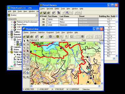
 GIS ObjectLand is a universal Geographic Information System utility that allows you to do many things , as it is displayed in the features below.
|
GIS ObjectLand is a universal Geographic Information System utility that allows you to do many things , as it is displayed in the features below.
GIS ObjectLand features
tags![]() between different and moving different geoinformation geoinformation databases the map table information merging and copying merging layers and arbitrary structure and feature feature types and editing
between different and moving different geoinformation geoinformation databases the map table information merging and copying merging layers and arbitrary structure and feature feature types and editing

Download GIS ObjectLand 2.7.9
Purchase: ![]() Buy GIS ObjectLand 2.7.9
Buy GIS ObjectLand 2.7.9
Authors software
 GIS ObjectLand 2.7.9
Radom-T
GIS ObjectLand is a universal Geographic Information System utility that allows you to do many things , as it is displayed in the features below.
Similar software
 GIS ObjectLand 2.7.9
Radom-T
GIS ObjectLand is a universal Geographic Information System utility that allows you to do many things , as it is displayed in the features below.
 DB Navigator 3.0.0
Desktop Software
DB Navigator is an application for the work with database tables of the DBF format.
 Cross-Database Studio 5.0
Cross Database Solutions
Cross-Database Studio 5.
 Tables Transformer for Excel 1.1.4
Office Assistance LLC
Tables Transformer for Excel will allow you to fast and easy perform the following transformations of Microsoft Excel tables:
· To prepare tabular data for the construction of pivot tables.
 dfbUtils standard 2.15
GW Associates
Database Editor/Utility at its Best.
 NetSET 1.2.2
DATA INVEST
The power of Spatial Editing Tool
NetSET by Data Invest is a powerful GIS solution designed for supporting the decision making process by helping to create, visualize, analyse and present the information in the best effective way.
 Interactive SQL for MySQL 2.2
microOLAP Technologies LLC
MyISQL (Interactive SQL for MySQL) is a handy utility for working with MySQL tables and queries.
 CDB Studio 4.0
dbBalance
CDB Studio is a full scale, integrated application for comparison, migration and synchronization of structures and data in databases of different types.
 Ezy Data 2000 4.2.1
aadconsulting.com
Ezy Data 2000 lets you easily create relational databases of tables and queries for entering, storing, viewing and analysing data.
 HTML Table Extractor 1.1
IEExtensions Software
HTML Table Extractor is an add-in for Internet Explorer (IE) allowing you to extract tables from web pages in an effective and quick manner.
Other software in this category
 WinNavigator 1.96
WinSoft
WinNavigator is a powerful and easy to use file manager.
 CuteZIP 2.1 Build 10.26.1
GlobalScape
CuteZIP offers superior ease-of-use, plus powerful security and archiving features for the most versatile compression utility on the market.
 Electrical Calculations 2.70.0.4
L.M. Photonics Ltd
Electrical Calculations software provides calculations for busbar and cable ratings, static and bulk power factor correction, motor starting currents and curves, enclosure ventiation, transformer calculations and many metric / imperial conversions and constants.
 mmSensitivity 2.07
MM&Soft Personal Service
Sensitivity Analysis add-in for Microsoft Excel 97, 98, 2000, and 2001 for Windows.
